Photographing the West Somerset Railway...
drag image sideways
The 2011 'Shoot the Photographers' event. Picture by Mike Dunse.
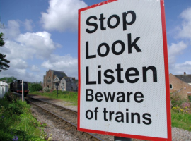
Stop, Look, Listen
We understand the WSR Plc has completed its review of its policy on Lineside Photography passes and at this point in time we recommend contacting the WSR Plc directly.
Please do not venture onto the lineside without the required training, appropriate personal protection equipment and valid permits.
Of course, many a great picture can be taken from public areas such as platforms where a permit is not necessary. See below...
Photospots

There are over 100 suggested public area locations with photo, coordinates, sat nav data and gradients on the Photospots webpage.
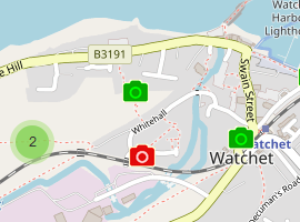
A second Photospots webpage showing a selection of photographic locations complete with example shots and shown on an interactive map.
Diagrams

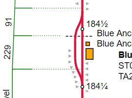
The gradient profile of the West Somerset Railway. Taken from official WSR documents. The drawings also show mileage and locations of bridges and stations.
From the Rule Book. The route in diagram form.
Submitting images

Technical advice for submitting images for use on wsr.org.uk
Copyright matters

Read how we use Creative Commons licensing on wsr.org.uk to help protect the work of our contributors.